MOTORCYCLE SAFETY High Altitude Roads Colorado
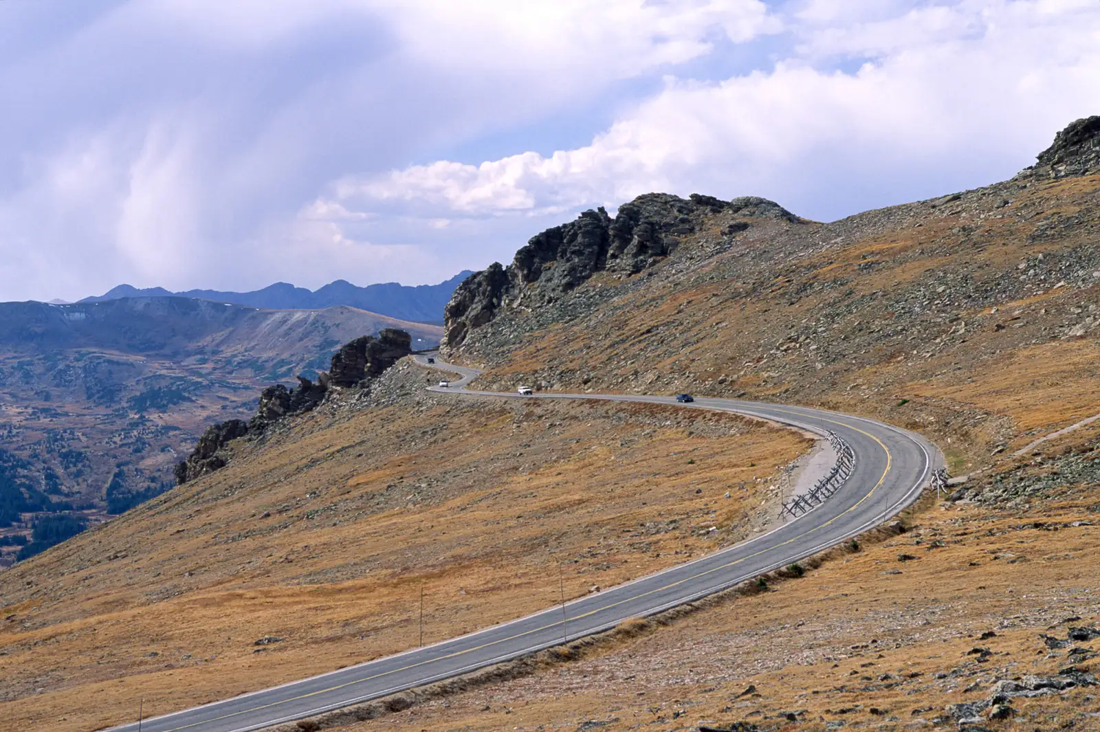
Colorado's high-altitude mountain roads, including Trail Ridge Road, present unique challenges that demand specialized safety knowledge and preparation. At elevations exceeding 12,000 feet, motorcycle riders face reduced oxygen levels, rapidly changing weather conditions, and technical riding demands that require comprehensive safety protocols. This guide provides essential information for safe mountain motorcycle travel based on decades of emergency response data and expert rider experience.
🚨 CRITICAL SAFETY FRAMEWORK
High-altitude motorcycle riding requires systematic risk management. Weather, altitude, and terrain create cumulative hazards that can overwhelm even experienced riders. Understanding and preparing for these challenges is essential for safe travel.
⚠️ High-Altitude Hazard Assessment
Primary Risk Factors
Altitude Effects (Above 10,000 feet):
- Oxygen Reduction: 25-30% less oxygen affects judgment and reaction times
- Engine Performance: 25-30% power loss impacts acceleration and climbing ability
- Dehydration: Accelerated due to dry air and increased respiratory rate
- Altitude Sickness: Headache, nausea, dizziness, impaired decision-making
Weather Volatility:
- Temperature Swings: 40°F+ variation from base to summit
- Sudden Storms: Lightning, hail, and wind develop within minutes
- Visibility Changes: Fog and clouds can reduce visibility to zero
- Surface Conditions: Ice possible any month above 11,000 feet
Statistical Safety Context
Rocky Mountain National Park emergency response data shows that while serious incidents occur, proper preparation dramatically reduces risk. The majority of incidents involve inadequate equipment, poor weather planning, or failure to recognize altitude effects.
Common Incident Factors:
- Inadequate cold weather gear (42% of weather-related incidents)
- Failure to monitor weather conditions (38% of incidents)
- Altitude sickness complications (28% of medical incidents)
- Mechanical failures due to altitude (15% of breakdowns)
📊 SAFETY PERSPECTIVE
Thousands of motorcycles safely traverse Trail Ridge Road annually. Incidents are preventable through proper preparation, equipment, and adherence to safety protocols. Knowledge and preparation are your primary safety tools.
🛡️ Essential Safety Equipment
Mandatory High-Altitude Gear
Protective Clothing System:
- Base Layer: Moisture-wicking thermal underwear (synthetic or merino wool)
- Insulation Layer: Down or synthetic insulation jacket
- Outer Shell: Waterproof, windproof jacket and pants
- Extremities: Insulated, waterproof gloves and boots
- Head Protection: Insulated helmet liner, balaclava for wind protection
Emergency Equipment:
- Communication: Satellite emergency beacon (cell coverage unreliable above 10,000 feet)
- Shelter: Emergency bivy or space blanket
- Nutrition: High-energy foods, electrolyte supplements
- Medical: First aid kit with altitude sickness medications
- Tools: Basic repair kit, tire repair, emergency fuel
Motorcycle Preparation
Pre-Ride Mechanical Check:
- Fuel System: Full tank plus reserve (high altitude reduces fuel efficiency)
- Carburetor: Adjust for altitude (fuel-injected bikes adapt automatically)
- Tires: Check pressure (altitude changes affect tire pressure)
- Brakes: Inspect pads and fluid (braking distances increase at altitude)
- Chain/Belt: Proper lubrication for cold weather operation
🌡️ Weather Safety Protocols
Pre-Ride Weather Assessment
Critical Weather Resources:
📞 Trail Ridge Road Conditions: (970) 586-1222
🌐 National Weather Service: Rocky Mountain National Park Weather
📱 Live Conditions: COtrip.org Traffic Cameras
GO/NO-GO Weather Criteria:
- Green Light: Clear skies, winds <15 mph, temperatures >40°F at summit
- Caution: Scattered clouds, winds 15-25 mph, temperatures 30-40°F
- Red Light: Thunderstorm forecast, winds >25 mph, temperatures <30°F
Real-Time Weather Monitoring
Critical Weather Signs to Abort Ride:
- Cloud Build-up: Cumulus clouds developing over peaks (thunderstorm precursor)
- Temperature Drop: >10°F decrease in 30 minutes
- Wind Increase: Sustained winds >30 mph or gusts >40 mph
- Visibility Reduction: Fog, snow, or cloud reducing visibility <1/4 mile
⚡ LIGHTNING SAFETY
Lightning is the #1 weather-related fatality risk above treeline. If thunder is heard, lightning is within 10 miles. Count seconds between lightning and thunder, divide by 5 for distance in miles. Seek shelter immediately if count is <30 seconds (6 miles).
🏥 Medical Safety & Emergency Response
Altitude Sickness Recognition & Response
Mild Symptoms (Monitor Closely):
- Headache (most common early sign)
- Mild nausea or loss of appetite
- Fatigue beyond normal exertion level
- Difficulty sleeping
Severe Symptoms (Descend Immediately):
- Severe headache unrelieved by pain medication
- Vomiting or persistent nausea
- Confusion, difficulty concentrating
- Loss of coordination, stumbling
- Rapid heart rate or breathing difficulty
Emergency Response Protocol:
1. Immediate Descent: Drop 1,000-2,000 feet elevation quickly
2. Call for Help: 911 or (970) 586-1399 (Rocky Mountain National Park)
3. Oxygen if Available: Supplemental oxygen can provide temporary relief
4. Monitor Vitals: Check breathing, pulse, consciousness level
Emergency Medical Facilities
Estes Park Medical Center
Full emergency and trauma services
Address: 555 Prospect Ave, Estes Park, CO 80517
Emergency: (970) 586-3344
Distance from Trail Ridge Road: 15 minutes to trailhead
Middle Park Medical Center
Critical access hospital serving Grand Lake area
Address: 1000 Robbie Rd, Granby, CO 80446
Emergency: (970) 725-0411
Distance from Trail Ridge Road: 25 minutes from Grand Lake
Flight for Life Colorado
Helicopter emergency medical services
Activation: Through 911 dispatch
Coverage: Weather permitting above 10,000 feet
Landing Zones: Alpine Visitor Center, Kawuneeche Visitor Center
🛣️ Technical Riding Safety
High-Altitude Cornering Techniques
Reduced Traction Factors:
- Cold Tires: Require longer warm-up periods at altitude
- Thin Air: Reduces aerodynamic stability and cooling efficiency
- Surface Changes: Ice, moisture, or debris more common at elevation
- Reduced Engine Braking: Less engine power means less compression braking
Recommended Adjustments:
- Entry Speed: Reduce by 15-20% compared to sea-level riding
- Throttle Control: Gradual application due to reduced engine response
- Braking Distance: Increase following distance by 50%
- Line Selection: Choose conservative lines with escape routes
Wind Management Techniques
High-Risk Wind Zones on Trail Ridge Road:
- Rock Cut (Mile 21-23): Most exposed section, crosswinds >40 mph possible
- Alpine Visitor Center (Mile 23): Wind funnel effect through mountain pass
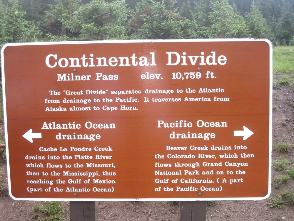
- Milner Pass (Mile 26): Continental Divide crossing with unpredictable gusts
- Fairview Curve (Mile 13): Exposed to valley wind patterns
Wind Riding Techniques:
- Body Position: Lower profile, firm grip on tank with knees
- Speed Management: Reduce speed in gusty conditions
- Steering Input: Small, smooth corrections to counter wind
- Lane Position: Adjust for wind direction and traffic
📞 Emergency Communication & Rescue
Communication Dead Zones
Limited Cell Coverage Areas:
- Mile 15-25: Spotty coverage above treeline
- Western Slope: Minimal coverage descending to Grand Lake
- Milner Pass Area: Geographic barriers block signals
Alternative Communication Methods:
- Satellite Emergency Beacons: SPOT, Garmin inReach devices
- Amateur Radio: 146.52 MHz emergency frequency
- Park Radio Channels: Monitor for ranger communications
- Signal Mirrors: Reflective devices for visual signaling
Search and Rescue Response
Rocky Mountain National Park SAR Team
Activation: Through 911 or (970) 586-1399
Response Time: 30-60 minutes to remote locations
Capabilities: Technical rescue, medical response, helicopter evacuation
Larimer County Search and Rescue
Coverage: Areas outside national park boundaries
Contact: Through Larimer County Sheriff (970) 416-1985
Specialties: High-angle rescue, wilderness medicine
📱 TECHNOLOGY TIP
Download offline maps before departing. GPS navigation works without cell service, but live traffic and weather updates require connectivity. Carry backup navigation methods including paper maps.
🔧 Mechanical Safety & Breakdown Response
High-Altitude Mechanical Challenges
Common Altitude-Related Issues:
- Fuel System: Vapor lock in carbureted bikes, fuel line freezing
- Electrical: Battery drain in cold conditions, condensation in connections
- Cooling: Overheating in thin air despite cool temperatures
- Tires: Pressure changes with altitude (1 PSI per 2,000 feet elevation)
Emergency Repair Kit:
- Tools: Basic wrench set, screwdrivers, electrical tape
- Spare Parts: Fuses, light bulbs, throttle/clutch cables
- Fluids: Small quantities of oil, brake fluid, coolant
- Tire Repair: Plug kit, CO2 cartridges, tire pressure gauge
- Emergency Fuel: 1-gallon reserve in approved container
Breakdown Response Protocol
Immediate Actions:
- Safe Positioning: Move completely off roadway, use hazard lights
- Visibility: Set up reflective markers 100 feet behind bike
- Call for Help: 911, park dispatch, or roadside assistance
- Shelter: Prepare for extended wait in adverse conditions
- Signal Location: Make yourself visible to search aircraft
Professional Recovery Services:
High Country Towing
Specialized motorcycle recovery and transport
Contact: (970) 586-3400
Coverage: 24/7 service to Trail Ridge Road
Equipment: Motorcycle-specific towing and trailer transport
🎓 Advanced Safety Training Resources
Recommended Training Programs
Colorado Motorcycle Safety Program
State-certified safety courses including mountain riding
Website: Colorado MOST Training
Courses: Basic, intermediate, and advanced mountain riding
Motorcycle Safety Foundation (MSF)
National safety training with local Colorado chapters
Website: MSF-USA.org
Specialties: Advanced RiderCourse, Total Rider Experience
BMW Motorcycle Owner of America (BMW MOA)
Mountain riding safety seminars and training events
Website: Motorcycle Safety Foundation
Focus: Adventure riding, high-altitude techniques
Wilderness Medicine Training
Wilderness Medical Associates
Wilderness First Responder and First Aid certification
Contact: (888) 742-2282
Courses: 2-day and 5-day wilderness medicine programs
📋 Safety Checklist Summary
Pre-Ride Safety Verification
Weather & Conditions:
- ☐ Check Trail Ridge Road status: (970) 586-1222
- ☐ Review weather forecast and lightning risk
- ☐ Verify road is open and accessible
- ☐ Plan turnaround times based on weather windows
Equipment & Preparation:
- ☐ Layered clothing system for 40°F temperature variation
- ☐ Emergency communication device with backup power
- ☐ Food, water, and emergency shelter
- ☐ Basic tool kit and tire repair capability
- ☐ First aid kit with altitude sickness medications
Motorcycle Preparation:
- ☐ Full fuel tank plus reserve
- ☐ Tire pressure adjusted for altitude
- ☐ Brakes and lights functioning properly
- ☐ Emergency contact information programmed
- ☐ Route plan shared with trusted contact
🛡️ SAFETY FIRST, ALWAYS
High-altitude motorcycle riding demands respect for the environment and comprehensive preparation. Weather can change in minutes, altitude affects performance and judgment, and help may be hours away. Your safety depends on preparation, proper equipment, and conservative decision-making. The mountains will be here tomorrow - ensure you are too.
🔗 Related Safety Resources
Colorado Motorcycle Safety:
🏍️ Trail Ridge Road Motorcycle Guide
🚁 Professional Guided Tours
⚠️ Dangerous Mountain Roads Guide
Emergency Information:
📞 Emergency Services: 911
📞 Rocky Mountain National Park: (970) 586-1399
📞 Trail Ridge Road Conditions: (970) 586-1222
🌐 Current Weather: National Weather Service