DANGEROUS MOUNTAIN ROADS COLORADO Safety Guide & Statistics 2025
Colorado's dangerous mountain roads represent some of the most challenging and deadly driving conditions in North America. From the cliff-hanging Million Dollar Highway to the alpine extremes of Trail Ridge Road, these mountainous routes demand respect, preparation, and advanced driving skills. This comprehensive safety guide examines Colorado's most dangerous mountain roads, provides critical accident statistics, and offers essential survival techniques for navigating these treacherous routes safely.
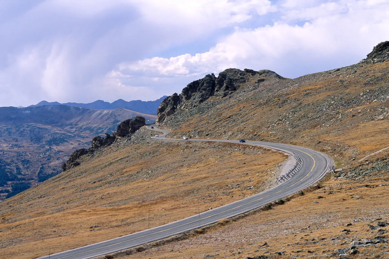
Understanding the specific risks, weather patterns, and emergency procedures for dangerous mountain roads can mean the difference between a memorable mountain adventure and a tragic outcome.
⚠️ CRITICAL SAFETY ALERT
- 🚨 Emergency Number: Call 911 or *CSP (*277) for Colorado State Patrol
- 📞 Road Conditions: Call 511 or dial *CDOT (*2368)
- ⛽ Fuel Rule: Never attempt mountain drives with less than 3/4 tank
- 📱 Communication: Satellite communicator recommended in remote areas
- 🎒 Emergency Kit: Food, water, blankets, first aid, tire chains
🏔️ Colorado's Most Dangerous Mountain Roads Ranked
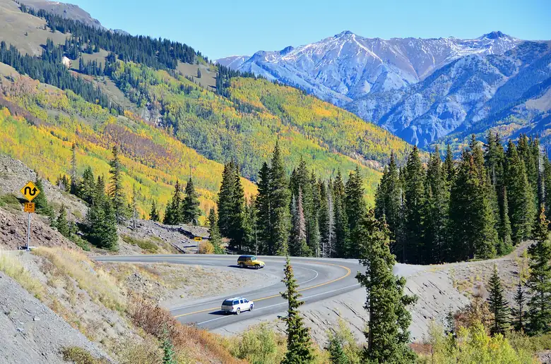
1. Million Dollar Highway (US 550) - Red Mountain Pass
The Deadliest: Consistently ranked among the world's most dangerous drives with sheer cliff drops and no guardrails.
Danger Statistics:
Fatality Rate: 1.6 crashes per mile
Elevation: 11,018 feet at Red Mountain Pass
Primary Hazards: Cliff drops, rockslides, weather extremes
Season: Year-round (winter conditions extremely hazardous)
💀 DEATH TRAP CHARACTERISTICS
Million Dollar Highway earned its name from the cost of construction—and the price paid in lives. The section between Silverton and Ouray lacks guardrails due to constant rockslides. Narrow lanes, 1,000-foot drops, and unpredictable weather create lethal conditions year-round.
2. Trail Ridge Road (US 34) - Rocky Mountain National Park
High-Altitude Extremes: America's highest continuous paved road presents unique dangers at 12,183 feet elevation.
Trail Ridge Road Deaths & Accidents:
Annual Incidents: 15-20 serious accidents per season
Primary Causes: Altitude sickness, weather exposure, vehicle failure
Fatality Factors: Lightning strikes, hypothermia, cardiac events
Rescue Time: 2-4 hours in remote sections
Unique Hazards:
- Lightning Zone: Above treeline during afternoon storms
- Altitude Sickness: Rapid ascent to 12,000+ feet
- Wildlife Encounters: Elk, moose, and bear crossings
- Weather Exposure: Snow possible any month
3. Interstate 70 Mountain Corridor
High-Volume Danger: Colorado's deadliest highway by total accidents with 300+ crashes annually in mountain sections.
Accident Statistics (2024 Data):
Total Crashes: 1,900+ annually in corridor
Fatal Accidents: 21 in three-year period
Peak Danger: Vail Pass to Glenwood Springs
Weather Factor: 70% of serious accidents during winter conditions
4. Independence Pass (Highway 82)
Continental Divide Peril: 12,095-foot elevation with narrow lanes and steep dropoffs.
Hazard Profile:
Road Width: 24 feet (no centerline in sections)
Gradient: 6-8% sustained climbs
Closure Period: October-May (avalanche danger)
Emergency Access: Limited to helicopter rescue above 10,000 feet
5. Schofield Pass - "S.O.B. Trail"
4WD Death Trap: Officially the most dangerous 4WD road in Colorado with multiple fatalities annually.
Extreme Conditions:
Vehicle Requirement: High-clearance 4WD only
Road Width: 8-10 feet with 500-foot dropoffs
Annual Fatalities: 2-3 deaths per year
Rescue Difficulty: Often requires multi-day operations
📊 Colorado Mountain Road Accident Statistics
Statewide Mountain Road Fatalities (2024)
- Total Mountain Road Deaths: 89 fatalities
- High-Altitude Crashes (8,000+ ft): 156 serious accidents
- Weather-Related Incidents: 67% of mountain crashes
- Tourist-Involved Accidents: 43% of summer incidents
- Single-Vehicle Crashes: 78% of mountain fatalities
Leading Causes of Mountain Road Deaths
- Speed/Loss of Control (34%): Excessive speed for conditions
- Weather Conditions (28%): Snow, ice, fog, sudden storms
- Vehicle Mechanical Failure (18%): Brake failure, overheating
- Medical Events (12%): Altitude sickness, cardiac episodes
- Wildlife Collisions (8%): Elk, deer, moose encounters
🛡️ Mountain Road Safety Protocols
Pre-Drive Safety Checklist
🔧 VEHICLE PREPARATION
- ✅ Brakes: Professional inspection within 6 months
- ✅ Tires: Minimum 4/32" tread depth, proper pressure
- ✅ Cooling System: Coolant levels, fan operation
- ✅ Transmission: Fluid levels, no leaks
- ✅ Emergency Kit: Chains, flares, first aid, food, water
High-Altitude Driving Techniques
Engine Braking Protocol:
- Downhill Sections: Use lower gears, not continuous braking
- Brake Temperature: Stop every 2-3 miles to cool brakes
- Speed Management: 15-20 mph below posted limits
- Following Distance: Triple normal distance in mountains
Weather Response Procedures:
- Sudden Storms: Pull off safely, wait it out
- Lightning Risk: Stay in vehicle, avoid high points
- Fog/Low Visibility: Headlights on, reduce speed by 50%
- Snow/Ice: Chains required, reduce speed to 25 mph maximum
🚨 Emergency Survival Procedures
Vehicle Breakdown Protocol
📞 EMERGENCY COMMUNICATION
Cell Coverage: Spotty or nonexistent above 9,000 feet. Satellite communicators (Garmin inReach, Spot) provide reliable emergency communication. Text 911 if voice calls fail. Stay with vehicle—rescuers can spot cars easier than people.
Immediate Actions:
- Signal for Help: Hazard lights, hood up, bright clothing
- Stay Warm: Run engine 10 minutes per hour, crack window
- Conserve Energy: Limit movement, share body heat
- Stay Hydrated: Melt snow for water if necessary
- Mark Location: GPS coordinates, nearby landmarks
Medical Emergency Response
Altitude Sickness Recognition:
- Mild Symptoms: Headache, nausea, fatigue
- Severe Symptoms: Confusion, difficulty breathing, loss of coordination
- Treatment: Immediate descent to lower elevation
- Prevention: Gradual ascent, hydration, avoid alcohol
🗺️ Route-Specific Safety Advisories
Trail Ridge Road Safety Zone Map
High-Risk Sections (GPS Coordinates):
- Many Parks Curve: 40.3847° N, 105.5892° W - Lightning risk
- Alpine Visitor Center: 40.4158° N, 105.7644° W - Medical emergencies
- Fall River Pass: 40.4169° N, 105.7589° W - Weather exposure
- Milner Pass: 40.4153° N, 105.8167° W - Continental Divide conditions
Million Dollar Highway Survival Zones
Critical Pull-Off Points:
- Molas Pass Summit: Last safe stop before descent
- Red Mountain Pass: Emergency parking only
- Ironton Ghost Town: Historical marker with cell service
- Ouray Hot Springs: Full services, medical clinic
📱 Technology & Safety Resources
Essential Apps & Communications
Navigation & Weather:
📱 Colorado 511: Real-time road conditions and closures
🌤️ Weather Underground: Mountain-specific forecasts
🗺️ Gaia GPS: Offline maps with coordinates
📡 What3Words: Precise location sharing for rescues
Emergency Communications:
📞 Colorado State Patrol: *CSP (*277)
🚨 Emergency Services: 911 (text if voice fails)
🛣️ Road Conditions: *CDOT (*2368)
⛑️ Mountain Rescue: Local sheriff departments coordinate
🏥 Medical & Rescue Resources
Mountain Medical Facilities
Front Range Access:
- Estes Park Medical Center: Full emergency services
- Vail Health Hospital: High-altitude medicine specialists
- St. Joseph Hospital (Denver): Level 1 trauma center
- Memorial Hospital (Colorado Springs): Mountain rescue coordination
Western Slope Resources:
- Mercy Regional Medical Center (Durango): Trauma services
- Gunnison Valley Hospital: Emergency and helicopter pad
- Community Hospital (Grand Junction): Regional trauma center
🏔️ RESPECT THE MOUNTAINS
Colorado's dangerous mountain roads have claimed hundreds of lives over the decades. These routes demand respect, preparation, and conservative decision-making. When in doubt, turn around. No destination is worth risking your life or the lives of others. The mountains will always be there—make sure you are too.