BEST SCENIC DRIVES IN COLORADO 2025 Complete Guide
Discover the best scenic drives in Colorado through this comprehensive guide to the state's most spectacular mountain routes. Colorado boasts more high-altitude scenic drives than anywhere else in North America, from the legendary Trail Ridge Road crossing the Continental Divide at 12,183 feet to the dramatic Million Dollar Highway clinging to San Juan Mountain cliffs. Whether you're seeking alpine tundra, historic mining heritage, or pristine wilderness corridors, Colorado's 25 official Scenic & Historic Byways plus dozens of additional remarkable drives offer unparalleled mountain experiences.
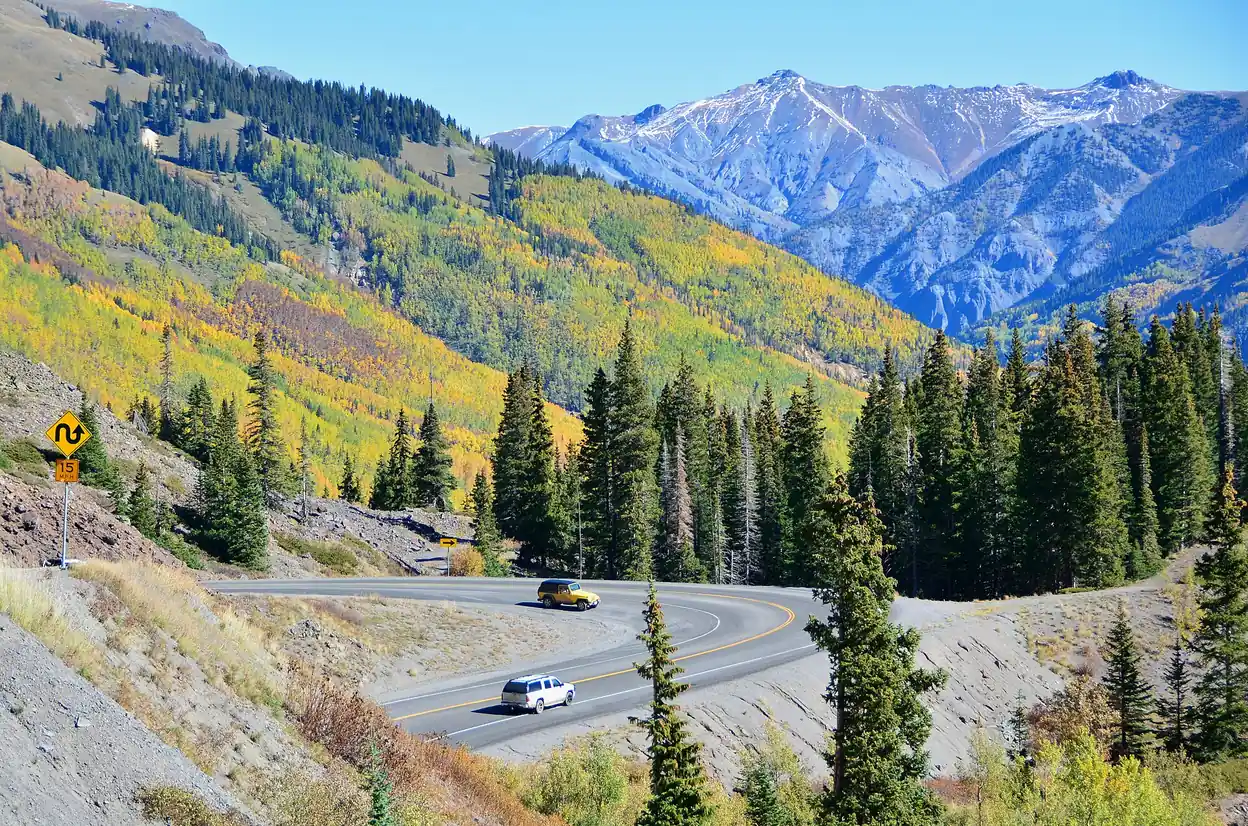
This guide ranks and details Colorado's most scenic drives based on elevation, engineering marvels, natural beauty, and accessibility, providing everything needed to plan unforgettable Rocky Mountain adventures.
📋 QUICK FACTS: Colorado Scenic Drives
- 🏔️ Total Scenic Byways: 25 official routes covering 3,000+ miles
- 🎯 Best Season: Late May through October for high-elevation drives
- ⛽ Fuel Up: Always fill tank before mountain drives - services are limited
- 📱 Cell Service: Spotty or non-existent on remote mountain sections
- 🚗 Vehicle Check: Ensure good brakes, tires, and cooling system
- ⏰ Plan Time: Mountain drives take 2-3x longer than flat terrain
🏔️ SCENIC BYWAY PROGRAM
Colorado's 25 official Scenic & Historic Byways cover over 3,000 miles of the state's most spectacular roads. Each byway tells a unique story through geology, history, and culture while providing access to recreational opportunities and natural wonders.
🌟 Top 10 Colorado Scenic Drives
1. Trail Ridge Road - Rocky Mountain National Park
The Crown Jewel: America's highest continuous paved road reaching 12,183 feet elevation through Rocky Mountain National Park.
Route Details:
Distance: 48 miles (Estes Park to Grand Lake)
Elevation Range: 7,522 - 12,183 feet
Season: Late May through October
Driving Time: 2-3 hours with stops
Highlights: Alpine tundra, Continental Divide, wildlife viewing, 13 distinct ecosystems
Key Stops:
- Many Parks Curve: Panoramic valley views
- Forest Canyon Overlook: Dramatic alpine scenery
- Alpine Visitor Center: Highest park visitor center in North America
- Milner Pass: Continental Divide crossing
Planning Info:
📞 Road Conditions: (970) 586-1222
🎫 Park Entry: $30 per vehicle (7-day pass)
⏰ Timed Entry: Required 9 AM - 2 PM ($2 additional fee)
🏆 #1 SCENIC DRIVE
Trail Ridge Road consistently ranks as America's most spectacular mountain drive. No other road provides comparable high-altitude alpine access combined with comprehensive visitor services and wildlife viewing opportunities.
2. Peak to Peak Scenic Byway (Highway 7 & 72)
Historic Mountain Corridor: Connecting Nederland, Ward, Allenspark, and Estes Park through pristine Front Range wilderness.
Route Details:
Distance: 55 miles
Elevation Range: 5,400 - 9,200 feet
Season: Year-round (winter conditions possible)
Driving Time: 2-3 hours
Highlights: Historic mining towns, continuous mountain vistas, Roosevelt National Forest
Must-See Attractions:
- Nederland: Quirky mountain town, Carousel of Happiness
- Ward: Historic mining settlement, excellent dining
- Allenspark: Gateway to Rocky Mountain National Park
- Lily Lake: Easy walking trail with mountain reflections
3. Mount Evans Scenic Byway (Highway 5)
Highest Paved Road to a Summit: The only road in North America providing automobile access to a 14,000-foot peak.
Route Details:
Distance: 28 miles (Idaho Springs to Summit Lake)
Elevation Range: 7,526 - 14,130 feet
Season: Late May through early October
Driving Time: 2-3 hours roundtrip
Highlights: Bighorn sheep, alpine lakes, 14er summit access
Notable Features:
- Echo Lake: Mountain lake with stunning reflections
- Summit Lake: Highest named lake accessible by car
- Mount Evans Summit: 14,130-foot peak with observation decks
- Bighorn Sheep Viewing: Frequent sightings along upper sections
Fee Information: $15 per vehicle (above Echo Lake)
4. Guanella Pass Scenic Byway (Highway 381)
Wildflower Paradise: Premier destination for alpine wildflower viewing and Continental Divide crossing.
Route Details:
Distance: 22 miles (Georgetown to Grant)
Elevation Range: 8,500 - 11,669 feet
Season: June through October
Driving Time: 1-2 hours
Highlights: Alpine wildflowers, 14er access, historic Georgetown
5. Independence Pass (Highway 82)
Continental Divide Spectacular: Connecting Aspen and Leadville across the Continental Divide through pristine alpine terrain.
Route Details:
Distance: 32 miles (Aspen to Twin Lakes)
Elevation Range: 9,065 - 12,095 feet
Season: Late May through October
Driving Time: 2-3 hours
Highlights: Historic mining ruins, alpine tundra, Continental Divide
6. Million Dollar Highway (US 550)
Engineering Marvel: Dramatic cliff-edge highway through the San Juan Mountains between Silverton and Ouray.
Route Details:
Distance: 25 miles (Silverton to Ouray)
Elevation Range: 7,706 - 11,008 feet
Season: Year-round (winter conditions require caution)
Driving Time: 1-2 hours
Highlights: Red Mountain Pass, Uncompahgre Gorge, mining history
7. Cottonwood Pass (Highway 306)
Sawatch Range Gateway: Crossing the Continental Divide through Colorado's highest mountain range.
Route Details:
Distance: 25 miles (Buena Vista to Taylor Park)
Elevation Range: 7,965 - 12,126 feet
Season: June through September
Driving Time: 1.5-2 hours
Highlights: 14er viewing, Taylor Park, Continental Divide
8. Gold Belt Tour Scenic Byway
Historic Mining Loop: Comprehensive tour of Colorado's gold mining heritage through Cripple Creek and Victor.
Route Details:
Distance: 135 miles (loop from Colorado Springs)
Elevation Range: 6,035 - 10,196 feet
Season: Year-round
Driving Time: 4-6 hours with stops
Highlights: Phantom Canyon Road, Cripple Creek, mining museums
9. San Juan Skyway
Ultimate Mountain Loop: 236-mile circuit through southwestern Colorado's most spectacular mountain scenery.
Route Details:
Distance: 236 miles (Durango loop)
Elevation Range: 6,512 - 10,910 feet
Season: Year-round (winter conditions on high passes)
Driving Time: 2-3 days recommended
Highlights: Mesa Verde, Telluride, Silverton, Million Dollar Highway
10. Collegiate Peaks Scenic Byway
14er Central: Showcase of Colorado's highest peaks through the heart of the Sawatch Range.
Route Details:
Distance: 57 miles (US 24 from Leadville to Buena Vista)
Elevation Range: 7,965 - 10,424 feet
Season: Year-round
Driving Time: 2-3 hours
Highlights: 14 peaks over 14,000 feet, Arkansas River, historic Leadville
📍 NAVIGATION TIP
Download offline maps before traveling. High-altitude areas often lack cell service. GPS units work without cell coverage, but real-time traffic and weather updates require connectivity.
📊 Complete Ranking: Best Scenic Drives in Colorado
🥇 DEFINITIVE RANKINGS
Based on elevation, scenic value, engineering achievement, and visitor experience, here are Colorado's top scenic drives ranked from most to least spectacular:
🏆 TOP 5 UNMISSABLE DRIVES
- Trail Ridge Road - 12,183 ft elevation, alpine tundra access
- Million Dollar Highway - Cliff-edge drama, Red Mountain Pass
- Independence Pass - 12,095 ft Continental Divide, historic ruins
- Mount Evans Scenic Byway - Only road to 14,000+ foot summit
- Peak to Peak Scenic Byway - 55 miles of continuous mountain vistas
🥈 EXCEPTIONAL EXPERIENCES (6-10)
- Guanella Pass - Premier wildflower viewing, 11,669 ft
- San Juan Skyway - 236-mile ultimate mountain loop
- Cottonwood Pass - Sawatch Range, 14er viewing
- Loveland Pass - I-70 alternative, 11,990 ft
- Kebler Pass - World's largest aspen grove
💎 Additional World-Class Colorado Drives
Glenwood Canyon (I-70)
Engineering Marvel: Four-level highway through dramatic Colorado River canyon with elevated bike paths and rest areas.
Route Details:
Distance: 12 miles (Dotsero to Glenwood Springs)
Elevation Range: 5,746 - 6,115 feet
Season: Year-round
Driving Time: 30-45 minutes
Highlights: Hanging Lake trailhead, Colorado River access, limestone cliffs
Wolf Creek Pass (US 160)
Continental Divide Crossing: Dramatic ascent through San Juan National Forest with panoramic mountain views.
Route Details:
Distance: 25 miles (South Fork to Pagosa Springs)
Elevation Range: 7,500 - 10,857 feet
Season: Year-round (winter conditions require caution)
Driving Time: 1 hour
Highlights: Continental Divide, San Juan Mountains, ski area access
Monarch Pass (US 50)
Continental Divide Gateway: Scenic route between Gunnison and Salida through Sawatch Range.
Route Details:
Distance: 35 miles (Gunnison to Salida)
Elevation Range: 7,036 - 11,312 feet
Season: Year-round
Driving Time: 1.5 hours
Highlights: Aerial tramway, Continental Divide, Sawatch views
🗺️ Best Scenic Drives by Region
Best Scenic Drives Near Denver
Within 2 Hours of Downtown Denver: Easy day trips showcasing Colorado's mountain splendor
🚗 SHORT SCENIC DRIVES FROM DENVER
- Mount Evans (1.5 hours): Highest paved road, bighorn sheep viewing
- Guanella Pass (1.5 hours): Georgetown to Grant, wildflower paradise
- Peak to Peak Byway (1 hour): Nederland to Estes Park mountain corridor
- Loveland Pass (1.5 hours): Continental Divide, 11,990 feet elevation
- Boulder Canyon (45 minutes): Dramatic canyon drive to Nederland
Front Range Scenic Drives
Boulder Area Drives:
- Boulder Canyon Drive (Highway 119): Nederland to Boulder through dramatic canyon
- Flagstaff Mountain Road: Boulder to summit with panoramic Front Range views
- Left Hand Canyon Drive: Boulder to Ward through historic mining corridor
Colorado Springs Area Drives:
- Pikes Peak Highway: America's Mountain to 14,115-foot summit
- Gold Camp Road: Historic railroad grade to mining camps
- Rampart Range Road: High country access through Pike National Forest
🌟 SCENIC DRIVES IN COLORADO SPRINGS
Colorado Springs serves as gateway to some of Colorado's most accessible scenic drives. Pikes Peak Highway offers summit access without the technical challenges of other 14ers, while Gold Camp Road provides historic mining heritage through moderate mountain terrain perfect for families.
Central Mountain Scenic Drives
I-70 Corridor Drives:
- Loveland Pass (US 6): Continental Divide crossing at 11,990 feet
- Hoosier Pass (Highway 9): Breckenridge to Fairplay crossing
- Vail Pass (I-70): Highway version of Continental Divide crossing
Western Slope Access:
- Kebler Pass: Crested Butte to Paonia through aspen groves
- McClure Pass (Highway 133): Carbondale to Paonia scenic route
- Grand Mesa Scenic Byway: World's largest flattop mountain
📅 Seasonal Planning Guide
Spring Scenic Driving (April - May)
Best Drives: Lower elevation routes with wildflower displays
- Cache la Poudre-North Park: Early wildflowers, flowing rivers
- Dinosaur Diamond: Desert blooms, comfortable temperatures
- Santa Fe Trail: Prairie wildflowers, historical sites
Limited Access: High-altitude passes typically closed until late May
Summer Peak Season (June - August)
All Roads Open: Peak season for high-altitude drives
- Trail Ridge Road: Full access, timed entry required
- Mount Evans: Best weather windows, bighorn sheep active
- Independence Pass: Wildflower season, alpine access
Considerations: Afternoon thunderstorms, higher traffic volume
Fall Color Season (September - October)
Aspen Viewing Prime Time: Colorado's famous golden aspens
- Peak to Peak Byway: Premier aspen viewing corridor
- Kebler Pass: Largest aspen grove in North America
- Guanella Pass: Mixed aspen and high-altitude scenery
Timing: Peak colors typically mid-September to early October
Winter Scenic Driving (November - March)
Year-Round Routes: Lower elevation scenic drives
- Gold Belt Tour: Historic mining areas, moderate elevations
- Highway of Legends: Cultural and historical focus
- Dinosaur Diamond: Desert landscapes, minimal snow
Closed Routes: Most high-altitude passes close October-May
❄️ WINTER DRIVING
Colorado requires traction law compliance (4WD/AWD or chains) from September 1 through May 31 on most mountain highways. Check current road conditions and carry emergency supplies for winter travel.
🗺️ Maps & GPS Navigation
📍 MOST SCENIC DRIVES IN COLORADO MAP
Interactive maps and GPS coordinates for Colorado's top scenic drives available through official Colorado Department of Transportation and National Scenic Byways resources. Download offline maps before departure as mountain areas frequently lack cell service.
Key GPS Coordinates for Top Drives
- Trail Ridge Road Start (Estes Park): 40.3772° N, 105.5217° W
- Independence Pass Summit: 39.1061° N, 106.5464° W
- Mount Evans Road Gate: 39.6581° N, 105.6428° W
- Million Dollar Highway (Red Mountain Pass): 37.8911° N, 107.7111° W
- Guanella Pass Summit: 39.5958° N, 105.7097° W
Navigation Resources:
📱 Colorado 511: Real-time road conditions and closures
🗺️ CDOT Travel Info: Official highway status updates
📡 Offline Maps: Essential for areas without cell coverage
🚗 Vehicle Preparation & Safety
High-Altitude Driving Requirements
Vehicle Preparation Checklist:
- Fuel: Fill tank before mountain travel (reduced efficiency at altitude)
- Fluids: Check coolant, brake fluid, power steering fluid
- Tires: Proper pressure, adequate tread depth
- Brakes: Recent inspection, avoid overheating on descents
- Emergency Kit: Food, water, blankets, first aid, tools
Colorado Traction Law
Requirements (September 1 - May 31):
- 4WD/AWD vehicles: 3/16" tread depth minimum
- 2WD vehicles: Mud/snow tires or chains required
- Commercial vehicles: Chains required regardless of drive type
- Penalties: $650+ fines for non-compliance
Chain Law Areas: I-70, US 40, US 160, US 550, and other designated mountain highways
📸 Photography & Scenic Viewing
Best Photography Locations
Sunrise Locations:
- Trail Ridge Road: Alpine Visitor Center, Many Parks Curve
- Mount Evans: Summit Lake, Echo Lake
- Guanella Pass: Georgetown Reservoir, Dry Gulch
Sunset Locations:
- Independence Pass: Twin Lakes overlook, Linkins Lake
- Million Dollar Highway: Crystal Lake, Bear Creek Falls
- San Juan Skyway: Lizard Head Pass, Trout Lake
Wildlife Viewing Opportunities
Common Wildlife by Route:
- Trail Ridge Road: Elk, bighorn sheep, marmots, pikas
- Mount Evans: Mountain goats, bighorn sheep, marmots
- Peak to Peak: Elk, moose, black bears
- San Juan Skyway: Elk, mule deer, black bears
Best Viewing Times: Early morning (6-10 AM) and evening (5-8 PM)
🏨 Accommodation & Services
Scenic Drive Headquarters
Front Range Base:
- Estes Park: Trail Ridge Road, Peak to Peak Byway access
- Boulder: Front Range drives, Rocky Mountain access
- Colorado Springs: Pikes Peak, Gold Belt Tour region
Central Mountains Base:
- Breckenridge: Hoosier Pass, Loveland Pass access
- Vail: I-70 corridor, central high country
- Leadville: Independence Pass, Cottonwood Pass
Western Colorado Base:
- Durango: San Juan Skyway, Million Dollar Highway
- Grand Junction: Grand Mesa, Colorado National Monument
- Steamboat Springs: Northern routes, Rabbit Ears Pass
Services and Facilities
Fuel and Services:
- Plan fuel stops - services limited on high-altitude routes
- Carry emergency fuel for remote areas
- Most mountain towns have auto repair services
- Cell service spotty above 10,000 feet
📱 Planning Resources & Technology
Essential Apps and Websites
Road Conditions:
🌐 COtrip.org - Real-time road conditions and cameras
📱 CDOT Mobile App - Official Colorado Department of Transportation app
☁️ Weather Underground - Detailed mountain weather forecasts
Navigation and Maps:
🗺️ Google Maps Offline - Download maps before traveling
🧭 Gaia GPS - Detailed topographic maps and offline capability
📍 AllTrails - Hiking opportunities along scenic routes
Official Scenic Byway Resources
Colorado Tourism Office:
🌐 Official Colorado Scenic Byways
📞 Colorado Tourism: (800) 865-2723
Individual Byway Information:
🏔️ Rocky Mountain National Park (Trail Ridge Road)
🌲 US Forest Service (National Forest routes)
🏛️ Bureau of Land Management (Public lands access)
📅 PLANNING TIP
Create flexible itineraries with alternative routes. Mountain weather changes rapidly, and high-altitude passes may close unexpectedly. Having backup plans ensures memorable experiences regardless of conditions.

🎯 Scenic Drive Recommendations by Interest
For Photography Enthusiasts
Top 5 Photography Drives:
- Trail Ridge Road: Alpine tundra, wildlife, dramatic elevation changes
- Mount Evans Scenic Byway: Bighorn sheep, alpine lakes, 14er summit access
- Million Dollar Highway: Cliff-edge drama, waterfall sequences
- Kebler Pass: Largest aspen grove, fall color spectacular
- Independence Pass: Continental Divide, mining ruins, alpine scenes
For History Buffs
Historic Routes:
- Gold Belt Tour: Comprehensive mining heritage experience
- Highway of Legends: Cultural history, coal mining legacy
- Santa Fe Trail: Pioneer and trade route history
- Top of the Rockies: Mining boom towns, railroad history
- Lariat Loop: Buffalo Bill territory, early Colorado tourism
For Adventure Seekers
Challenging Drives:
- Black Bear Pass: 4WD only, extreme exposure (experienced drivers only)
- Imogene Pass: Telluride to Ouray, high-clearance 4WD required
- Old Fall River Road: Historic one-way ascent, gravel surface
- Engineer Pass: Lake City to Ouray, mining district access
- Pearl Pass: Aspen to Crested Butte, high-altitude challenge
⚠️ 4WD ROUTES WARNING
4WD-only routes require high-clearance vehicles, experienced drivers, and emergency preparedness. Weather can change rapidly, creating dangerous conditions. Never attempt these routes alone or without proper equipment.
🌡️ Weather and Seasonal Closures
High-Altitude Pass Closure Schedule
Typical Closure Periods:
- Trail Ridge Road: Mid-October to late May
- Independence Pass: November to May
- Cottonwood Pass: November to June
- Guanella Pass: December to May (partial closures)
- Mount Evans: October to late May
Variable Closure Factors:
- Snow accumulation and avalanche danger
- Maintenance crew availability
- Weather patterns and early/late storms
- Budget considerations for snow removal
Real-Time Condition Monitoring
Essential Resources:
📞 Road Conditions Hotline: 511 (Colorado statewide)
🌐 COtrip.org: Live cameras and road status
📱 Weather Alerts: National Weather Service mobile alerts
🏔️ Avalanche Information: Colorado Avalanche Information Center
🔗 Related Scenic Drive Resources
Detailed Route Guides:
🏔️ Trail Ridge Road Motorcycle Guide
🚗 Colorado Motorcycle Tours
📸 Photography & Wildlife Guide
Safety and Planning:
⚠️ High-Altitude Safety Guide
🌡️ Weather & Conditions
🗺️ Interactive Trail Ridge Road Map
🏔️ DISCOVER COLORADO'S MAJESTY
Colorado's scenic byways offer unparalleled access to some of North America's most spectacular mountain landscapes. From the alpine tundra of Trail Ridge Road to the historic mining heritage of the Gold Belt Tour, each route tells a unique story while providing unforgettable experiences. Plan ahead, drive safely, and prepare to be amazed by the diverse beauty of the Colorado Rockies.