Trail Ridge Road Elevation Guide 2025
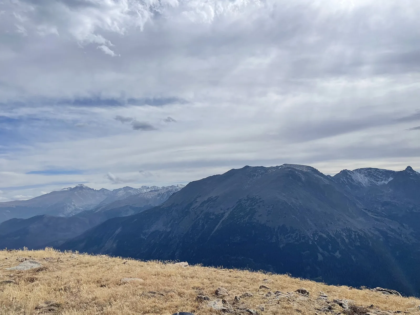
Trail Ridge Road stands as North America's highest continuous paved road, reaching an extraordinary elevation of 12,183 feet above sea level. This comprehensive elevation guide provides detailed information about heights, viewpoints, altitude considerations, and essential facts for planning your high-altitude adventure through Rocky Mountain National Park.
🏔️ Key Elevation Facts
- Highest Point: 12,183 feet (3,713 meters) above sea level
- Treeline Elevation: Approximately 11,500 feet
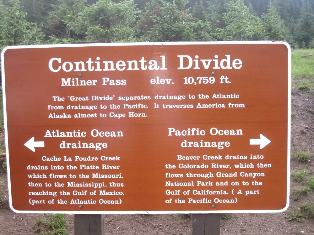
- Continental Divide Crossing: Milner Pass at 10,758 feet
- Alpine Tundra Distance: 11 miles above treeline
Complete Elevation Profile
Trail Ridge Road's 48-mile journey from Estes Park to Grand Lake features dramatic elevation changes that showcase Colorado's diverse ecosystems. Understanding these elevations helps visitors prepare for altitude effects and plan optimal stops for photography and sightseeing.
Eastern Approach (Estes Park to Alpine Visitor Center)
📊 Major Elevation Points - East Side
- Estes Park: 7,522 feet (starting elevation)
- Beaver Meadows Entrance: 8,050 feet
- Deer Ridge Junction: 8,937 feet
- Hidden Valley: 9,240 feet
- Many Parks Curve: 9,620 feet
- Rainbow Curve: 10,829 feet
- Forest Canyon Overlook: 11,716 feet
- Rock Cut: 12,110 feet
- Highest Point: 12,183 feet
- Fall River Pass/Alpine Visitor Center: 11,796 feet
Western Approach (Grand Lake to Alpine Visitor Center)
📊 Major Elevation Points - West Side
- Grand Lake: 8,369 feet (starting elevation)
- Kawuneeche Visitor Center: 8,720 feet
- Timber Creek Campground: 8,900 feet
- Fairview Curve: 9,980 feet
- Lake Irene: 10,700 feet
- Milner Pass (Continental Divide): 10,758 feet
- Medicine Bow Curve: 11,640 feet
- Fall River Pass/Alpine Visitor Center: 11,796 feet
Understanding Trail Ridge Road's Record-Breaking Height
At 12,183 feet above sea level, Trail Ridge Road holds the distinction of being the highest continuous paved road in North America. This elevation places the road well above treeline, where harsh conditions prevent forest growth and create the unique alpine tundra environment that makes the drive so spectacular.
The road's construction at such extreme altitude represents an engineering marvel. Completed in 1932, the route required innovative techniques to build a stable roadway capable of withstanding severe weather conditions including 200+ mph winds, temperatures dropping to -40°F, and snow accumulations exceeding 30 feet annually.
🔍 Elevation Comparisons
Trail Ridge Road vs. Other High Roads:
- Trail Ridge Road: 12,183 feet (Colorado) - Highest continuous paved road
- Mount Washington Auto Road: 6,288 feet (New Hampshire)
- Going-to-the-Sun Road: 6,646 feet (Montana)
- Beartooth Highway: 10,947 feet (Montana/Wyoming)
- Mount Evans Scenic Byway: 14,130 feet (Colorado) - Higher but not continuous
Altitude Effects and Health Considerations
The dramatic elevation gain from Estes Park (7,522 feet) to Trail Ridge Road's highest point (12,183 feet) creates a 4,661-foot increase that can significantly impact visitors. Understanding altitude effects helps ensure a safe and enjoyable experience.
Altitude Sickness Symptoms
Symptoms typically begin affecting sensitive individuals above 8,000 feet and become more common above 10,000 feet. Common symptoms include:
- Headaches and dizziness
- Nausea and loss of appetite
- Fatigue and weakness
- Shortness of breath during minimal exertion
- Difficulty sleeping
- Rapid heartbeat
⚠️ High-Altitude Safety Guidelines
- Ascend Gradually: Allow time for acclimatization, especially above 10,000 feet
- Stay Hydrated: Drink water frequently; dehydration exacerbates altitude effects
- Avoid Alcohol: Alcohol increases dehydration and altitude sickness symptoms
- Recognize Symptoms: If experiencing severe symptoms, descend immediately
- Emergency Response: Call 911 or (970) 586-1399 for medical emergencies
Climate and Weather by Elevation
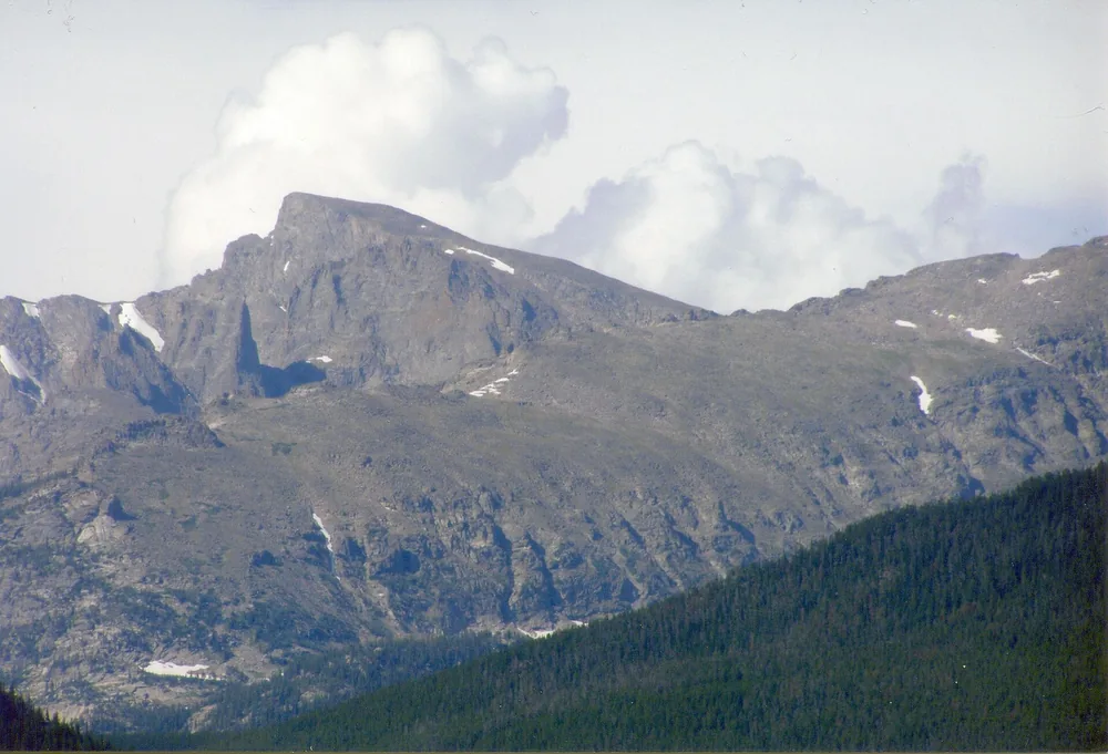
Trail Ridge Road's elevation creates dramatic climate variations along its route. Weather conditions can differ significantly between the road's eastern entrance and its highest points, sometimes varying by 20-30 degrees Fahrenheit.
Temperature Variations by Elevation
🌡️ Average Summer Temperatures (July)
- Estes Park (7,522 feet): High 80°F, Low 45°F
- Rainbow Curve (10,829 feet): High 70°F, Low 35°F
- Highest Point (12,183 feet): High 61°F, Low 30°F
- Alpine Visitor Center (11,796 feet): High 65°F, Low 32°F
Precipitation and Snow
Higher elevations receive significantly more precipitation, with the alpine areas often experiencing afternoon thunderstorms during summer months. Snow can occur at any time of year above 11,000 feet, with accumulations beginning as early as September and lasting through June.
Viewpoints and Photography Elevations
Trail Ridge Road offers numerous designated viewpoints, each providing unique perspectives of the Rocky Mountains. Understanding elevation helps photographers plan optimal lighting and weather conditions.
Premier Photography Locations by Elevation
📸 Top Viewpoints with Elevations
- Many Parks Curve (9,620 feet): Panoramic views of Estes Valley and Front Range
- Rainbow Curve (10,829 feet): Named for frequent rainbow sightings after storms
- Forest Canyon Overlook (11,716 feet): Deep canyon views and treeline perspective
- Rock Cut (12,110 feet): Alpine tundra environment and Trail Ridge Store
- Highest Point (12,183 feet): 360-degree mountain vistas
- Gore Range Overlook (12,050 feet): Views toward distant Gore Range
- Alpine Visitor Center (11,796 feet): Facilities and wildlife viewing
Seasonal Elevation Access
Trail Ridge Road's elevation significantly impacts seasonal accessibility. The road's closure schedule directly correlates with elevation, as higher sections experience severe weather conditions that make travel dangerous or impossible.
2025 Opening Schedule by Elevation
Full Road Opening: May 30, 2025 (latest opening date in recent history)
Typical Closure: Mid to late October, depending on snow conditions
Last Guaranteed Access: Labor Day weekend (weather permitting)
Limited Access During Closure
When Trail Ridge Road closes for winter, visitors can still access lower elevation sections:
- East Side Access: Up to approximately 10,000 feet (varies by snow conditions)
- West Side Access: Up to approximately 9,000 feet from Grand Lake
- Seasonal Gates: Located at strategic elevation points for safety
🗓️ Planning Your Visit by Season
- Peak Season (July-August): Full elevation access, warmest weather, crowded conditions
- Early Season (June): Possible snow walls, cooler temperatures, lighter crowds
- Late Season (September-October): Fall colors, variable weather, potential early closure
- Winter (November-May): Limited elevation access, extreme weather, specialized equipment required
Driving Tips for High Elevation
Driving at Trail Ridge Road's extreme elevations requires special considerations for vehicle performance, safety, and comfort. The thin air affects both vehicle performance and driver well-being.
Vehicle Performance at Altitude
Engine Power Loss: Vehicles lose approximately 3% of power for every 1,000 feet of elevation gain. At 12,183 feet, expect a 36% reduction in engine power compared to sea level performance.
Cooling System Stress: Thin air provides less cooling efficiency, increasing the risk of engine overheating, especially during steep climbs or stop-and-go traffic.
Tire Pressure Changes: Tire pressure decreases with altitude; check and adjust as needed for optimal performance and safety.
🚗 High-Altitude Driving Checklist
- Vehicle Inspection: Check cooling system, brakes, and tire condition before departure
- Fuel Considerations: Fill tank in Estes Park or Grand Lake; no services at high elevation
- Emergency Kit: Include warm clothing, water, snacks, and first aid supplies
- Weather Monitoring: Check current conditions; weather changes rapidly at altitude
- Escape Routes: Know turnback points if weather deteriorates
Wildlife and Elevation Zones
Trail Ridge Road's elevation creates distinct ecological zones, each supporting different wildlife populations. Understanding these zones enhances wildlife viewing opportunities and safety awareness.
Ecological Zones by Elevation
Montane Zone (8,000-9,500 feet): Ponderosa pine, elk, deer, black bear, mountain lion
Subalpine Zone (9,500-11,500 feet): Engelmann spruce, subalpine fir, moose, bighorn sheep
Alpine Zone (11,500+ feet): Alpine tundra, marmots, pikas, ptarmigan, mountain goats
Elevation Emergency Information
Trail Ridge Road's remote high-altitude location requires specific emergency preparedness. Cell phone coverage is limited above 11,000 feet, and weather conditions can change rapidly.
🚨 Emergency Contacts and Procedures
- Emergency Services: 911 (limited cell coverage above 11,000 feet)
- Park Emergency: (970) 586-1399
- Road Conditions: (970) 586-1222
- Alpine Visitor Center: (970) 586-1206 (seasonal operation)
- Emergency Procedures: Descend to lower elevation, seek shelter, signal for help
Planning Your High-Altitude Adventure
Successfully experiencing Trail Ridge Road's extreme elevations requires careful planning, appropriate preparation, and respect for the mountain environment. Allow a full day for the complete journey, including stops for acclimatization, photography, and wildlife viewing.
The elevation journey from Estes Park to Trail Ridge Road's highest point represents more than a simple drive—it's an ascent through multiple ecosystems to one of North America's most spectacular high-altitude landscapes. Understanding and respecting these elevations ensures a safe, memorable, and transformative mountain experience.