Driving Trail Ridge Road End to End: Estes Park to Grand Lake
Trail Ridge Road is U.S. Highway 34 inside Rocky Mountain National Park, 48 miles between Estes Park on the park's east side and Grand Lake on the west. In steady traffic the park puts the crossing at 1.5 to 2 hours; plan two hours of driving and three to four hours with stops. The road is two-way — it runs in both directions, all season, and the park publishes no one-way rule for it.
What follows is the whole route in one table: every named stop, its elevation, and how far it is from each end — so you can read the page in whichever direction you are driving it.
The drive in four lines
Distance: 48 miles, Estes Park to Grand Lake.
Driving time: 1.5–2 hours moving; three to four hours with stops; half a day to do it properly.
High point: 12,183 feet. The park does not name the spot, and it is not at the visitor centre.
Season: open to through travel from late May to mid-October, weather permitting.
🛣️ The road end to end: every stop, both directions
These distances are the park's own. The east column is miles from Beaver Meadows Visitor Center; the west column is miles from Kawuneeche Visitor Center. The two centres are 43.6 miles apart on this road, and the park's 48-mile figure measures the two towns.
| Stop, in driving order | Elevation | Miles from Beaver Meadows VC (east) | Miles from Kawuneeche VC (west) |
|---|---|---|---|
| Fall River Entrance — east gate, U.S. 34 | 8,280 ft | 8.3 through the park (6.0 through downtown Estes Park) | 43.3 |
| Many Parks Curve | 9,640 ft | 8.3 | 35.3 |
| Rainbow Curve | 10,829 ft | 12.1 | 31.6 |
| Forest Canyon Overlook | 11,716 ft | 16.8 | 26.8 |
| Rock Cut — Tundra Communities Trailhead | 12,050 ft | 18.8 | 24.8 |
| Lava Cliffs parking area | 12,000 ft | 20.9 | 22.7 |
| Gore Range Overlook | 12,010 ft | 22.0 | 21.6 |
| Alpine Visitor Center — the midpoint | 11,796 ft | 23.0 | 20.6 |
| Medicine Bow Overlook | 11,660 ft | 23.4 | 20.2 |
| Milner Pass — Poudre Lake, the Continental Divide | 10,758 ft | 27.3 | 16.3 |
| Lake Irene picnic area | 10,748 ft | 27.8 | 15.8 |
| Farview Curve | 10,120 ft | 29.5 | 14.1 |
| Timber Creek Campground | 8,900 ft | 38.0 | 8.2 |
| Kawuneeche Visitor Center | 8,720 ft | 43.6 | 0 |
| Grand Lake Entrance — west gate | 8,715 ft | 43.2 | 0.4 |
Two things about that table are worth saying out loud, because they are where most through-drive pages go wrong. The road's high point is 12,183 feet — the park publishes the elevation, and publishes no place name to go with it, so no stop on this table is "the summit". And the Alpine Visitor Center is not it either: the centre sits at 11,796 feet, at the top of Fall River Pass, roughly 390 feet below the high point.
⏱️ How long the drive takes
| What you are timing | Time | Where the number comes from |
|---|---|---|
| Moving, one way, in steady traffic | 1.5–2 hours | National Park Service |
| Time to plan as driving | 2 hours | National Park Service (its own duration field); the Colorado Tourism Office also allows 2 hours for the byway |
| With stops at the overlooks | 3–4 hours | Our own estimate — not a park figure |
| To do it properly | At least half a day | National Park Service: "Put aside at least a half day for the trip. Longer, if possible." |
The 1.5-hour end of the park's range is its steady-traffic best case, not a planning figure. Two hours is the number to plan with, and if you are stopping at the overlooks — which is the point of the road — you are spending most of a morning or an afternoon on it. Add the time spent queueing for a space at the visitor centre car park in season.
🧭 Which way round to drive it
Our recommendation: east to west, starting early. That is Estes Park to Grand Lake, with the Alpine Visitor Center halfway.
Four reasons, in the order they matter:
- It is the way you arrive. If you are coming from Denver and the Front Range, Estes Park is the end you reach first, and both of the park's eastern entrances — Fall River on U.S. 34 and Beaver Meadows on U.S. 36 — put you straight onto the road. Our location and access guide covers the approach.
- The scenery starts in the first twelve miles. Many Parks Curve is 8.3 miles from the Beaver Meadows centre and Rainbow Curve 12.1, the first two viewpoints above the valley floor. If the weather turns and you have to come back down, you have still seen the road.
- The light. East to west in the morning puts the sun behind you; if you have to run it the other way, do it in the afternoon for the same reason. Midday over the tundra flattens everything.
- It ends on the west side. The town of Grand Lake is about a mile past the Grand Lake Entrance, so the drive finishes on the quiet side of the park rather than in the traffic coming out of Estes Park at the end of the afternoon.
Drive it the other way — Grand Lake to Estes Park — if you are coming from Grand County and I-70, or if you are sleeping on the west side and want the descent into Estes Park for dinner. The road itself is identical: same 48 miles, same stops in mirror order, same two-hour crossing. Nothing about the direction changes what you are allowed to do.
🚗 The stops, east to west
Many Parks Curve — 9,640 ft, 8.3 miles in
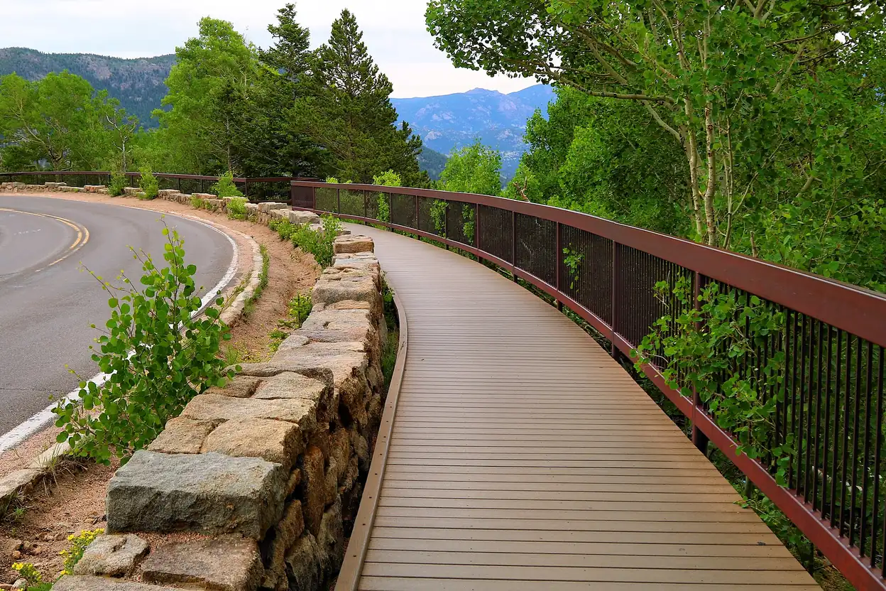
The first place the road properly climbs, and usually the point where the winter closure begins on the east side: below it, the road stays open from Estes Park through the winter; above it, it shuts. In summer it is a curve with a view back over the valleys you have just driven through, and a boardwalk out to the railing.
Rainbow Curve — 10,829 ft, 12.1 miles in
Just under four miles further and about 1,200 feet higher, and the last of the two curves that look back down the valley you climbed out of. From here the road is into the alpine stretch: Forest Canyon, Rock Cut and Lava Cliffs all have pullouts of their own, so this is not your last chance to stop — it is the last one that faces back the way you came.
Forest Canyon Overlook — 11,716 ft, 16.8 miles in
The first overlook that looks into the park rather than back out of it: it is named for the canyon it faces. The pullout is short, and this is the stop worth taking slowly.
Rock Cut — 12,050 ft, 18.8 miles in
High on the tundra, and the trailhead for the Tundra Communities Trail, which leaves from the car park onto the open ground above the trees.
Lava Cliffs — 12,000 ft, 20.9 miles in
A parking area on the stretch where the road runs across the top of the mountain. Take it for the altitude rather than for a marked viewpoint.
Alpine Visitor Center — 11,796 ft, 23 miles in
The midpoint and the only visitor centre on the road itself. It sits at the top of Fall River Pass and the park calls it the highest-elevation visitor center in the National Park System. Inside: a staffed information desk, alpine-tundra exhibits and Junior Ranger badges. Next door, the Trail Ridge Store has a small café, a gift shop and a storm shelter; there are vault toilets across the parking area, with running water and flush restrooms in midsummer. Emergency medical services are available here. It is open in summer only, and it can close temporarily at any time for weather.
Dress for 12,000 feet, not for the town
The park's own warning: the tundra is normally windy and 20 to 30 degrees colder than Estes Park or Grand Lake, and you climb some 4,000 feet in a matter of minutes. A jacket in the car is the difference between a twenty-minute stop and a two-minute one.
Milner Pass — 10,758 ft, 27.3 miles in
Where the road crosses the Continental Divide, at Poudre Lake. The park calls 10,758 feet a surprisingly low crossing for a divide, and after the tundra above Rock Cut it feels like coming down into another country.
Farview Curve — 10,120 ft, 29.5 miles in
The last of the high viewpoints before the descent, looking north up the Kawuneeche Valley.
Kawuneeche Visitor Center and the Grand Lake Entrance — 8,720 ft and 8,715 ft, 43.6 and 43.2 miles in
The west end: the visitor centre sits 0.4 miles inside the Grand Lake Entrance and 1.4 miles from the town of Grand Lake, so the drive ends a minute or two after the gate.
🚧 If the road is closed
Trail Ridge Road is a seasonal road. The park describes it as closed to through travel from mid-October to late May, with the exact dates moving each year with the weather, and the closures are weather-driven rather than planned. When it shuts, it shuts in the middle: from Estes Park you can drive as far as Many Parks Curve (9,640 ft), and from Grand Lake as far as Colorado River Trailhead (8,990 ft). The two towns stay open; the road between them does not.
The 2026 season opened on Friday 29 May and through travel ended at 5 p.m. on Friday 23 October 2026. The park's opening-and-closing table, last updated in 2015, puts the average winter closure at 23 October, and recent years show how far a season can stray from it: the road stayed open until 14 November in 2025. Opening dates in that table have ranged from 7 May (2002) to 26 June (1943).
- Live status: call the park's recorded line on (970) 586-1222, available 24 hours a day.
- Dates and current state: our opening and closing page tracks the gates, the season and what has been published for the next one.
- Weather and driving conditions: the conditions and weather page is the one to open on the morning you travel.
❓ What the road is, and what it is not
It is two-way
Trail Ridge Road carries traffic in both directions for its whole length, and the park describes the drive from either end. It is a two-lane road, designed that way on purpose so that the roadway did as little damage as possible to the alpine ground it crosses. Nothing on this route is one-way, and there is no uphill-only or peak-hours single-direction rule.
The one-way rule belongs to a different road
Old Fall River Road is the one-way road in this corridor: 9.4 miles, unpaved, uphill only, starting near Endovalley and merging with Trail Ridge Road at the top of Fall River Pass. It is a separate drive, and its rules are its own.
There is no vehicle-length limit on Trail Ridge Road
The park publishes no length limit and no vehicle-type prohibition for Trail Ridge Road. The rule people confuse with it — nothing over 25 feet, and no trailers or towed vehicles — is Old Fall River Road's, because of its narrow width and switchbacks, and it does not apply to the through-drive. Long vehicles still have a practical problem: the overlook pullouts are short and busy, so use the developed car parks at Rock Cut, Lava Cliffs and the visitor centre rather than a roadside curve.
The high point is not where you park
12,183 feet is the road's high point and the park does not attach it to a named place. The visitor centre at 11,796 feet is not the summit, and neither is Rock Cut at 12,050 feet. If you want the number, take it as a number.
Where to go next
The map page puts the whole route and its GPS waypoints on one screen; the lookout points guide goes stop by stop with coordinates; the opening page tells you whether the gates are open today.
Sources for this page: National Park Service — the distance and elevation chart (https://www.nps.gov/romo/planyourvisit/distances-and-elevations.htm), the scenic-drive page (https://www.nps.gov/thingstodo/enjoy-a-scenic-drive-on-trail-ridge-road.htm), the road-status page (https://www.nps.gov/romo/planyourvisit/road_status.htm), the park hours page (https://www.nps.gov/romo/planyourvisit/hours.htm), the opening-and-closing table (https://www.nps.gov/romo/learn/photosmultimedia/opening_closing_trr_ofr.htm), the Alpine Visitor Center (https://www.nps.gov/romo/learn/kidsyouth/index.htm), the Trail Ridge Store (https://www.nps.gov/places/romo_trailridgestore.htm) and the historic-roads page (https://www.nps.gov/romo/learn/historyculture/historic_roads.htm); the closure date from the park's 23 October 2026 alert; and the Colorado Tourism Office byway page (https://colorado.com/byways/trail-ridge-road). All read 12 November 2026 except the 2026 closure, read 8 November 2026. The 3–4 hour figure with stops is ours and is labelled as ours above.